

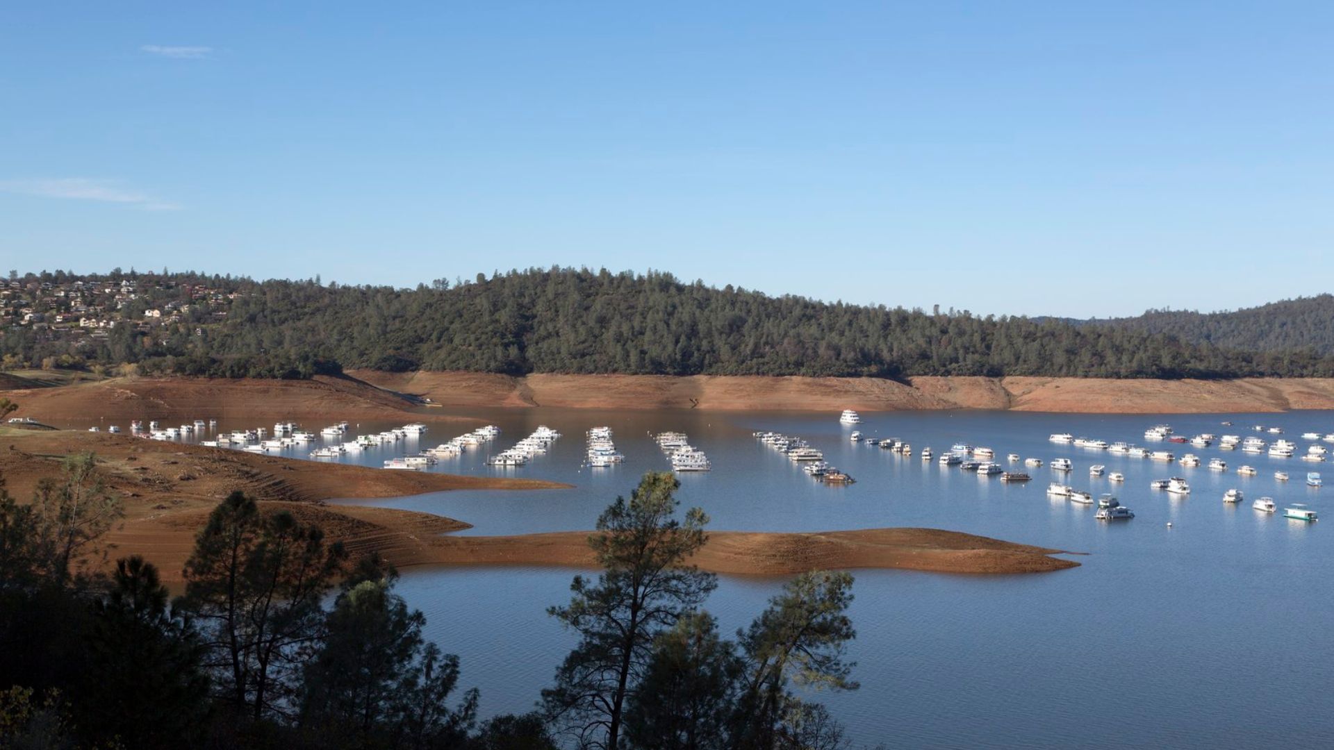
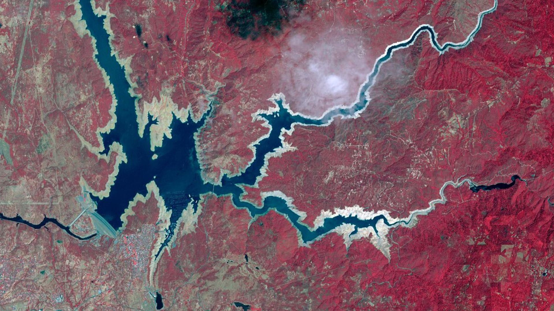
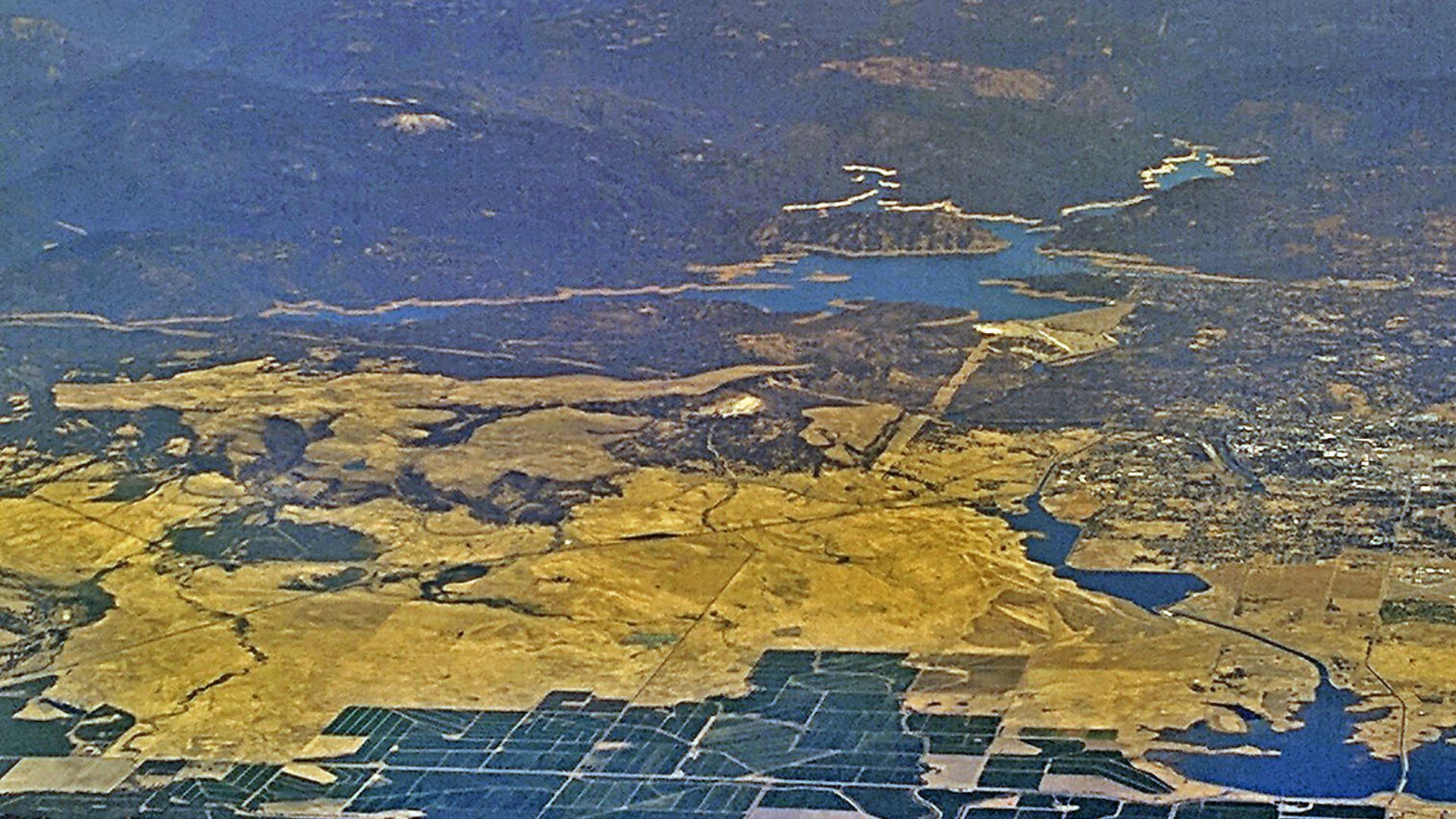
Recent studies by the California Department of Water Resources (DWR) reveal that Lake Oroville, a vital water source as the state’s second largest reservoir, has seen a troubling 3% drop in capacity since the 1960s.
This significant change was uncovered with the latest in terrain-mapping technologies, providing a fresh perspective on the reservoir’s volume.
Mapping the Depths
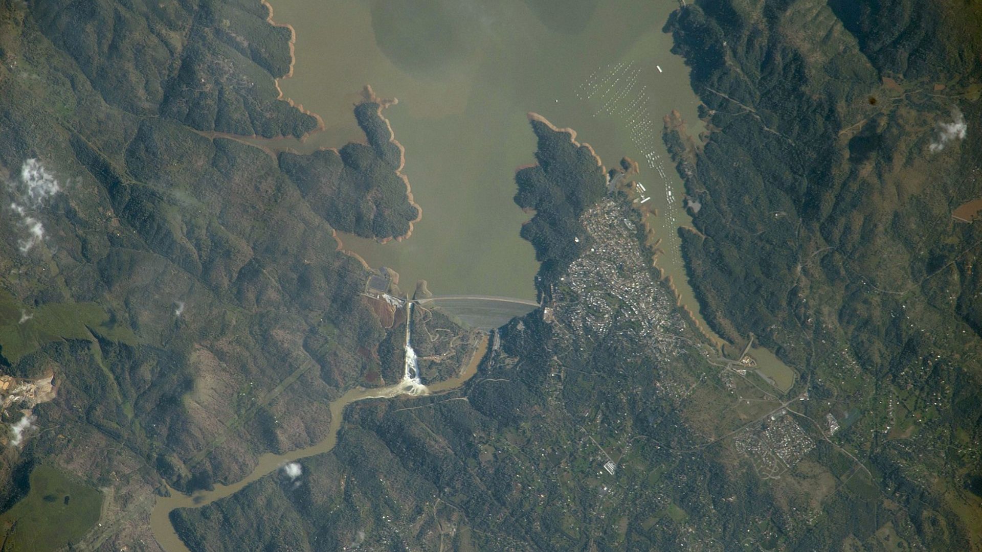
To better understand the changes in Lake Oroville, the DWR turned to advanced terrain-mapping technology.
As detailed on the DWR webpage, this led to the creation of “highly detailed 3D topographic terrain models of the bottom of the lake,” essential for reassessing the reservoir’s current capacity.
When Rivers Flow in the Sky
Lake Oroville has been greatly affected by atmospheric rivers, particularly after enduring severe droughts.
These unique weather phenomena, described by the National Oceanic and Atmospheric Administration as “long, narrow regions in the atmosphere—like rivers in the sky,” are crucial for transporting water vapor from the tropics.
The Lifeline of California’s Reservoirs
Atmospheric rivers have become key to replenishing water in California’s reservoirs like Lake Oroville, especially after intense drought periods.
These rivers in the sky are critical for moving vast amounts of water vapor, directly impacting the state’s water resources and climate.
A Shifting Foundation
The DWR’s recent use of cutting-edge technology has brought some concerning news: Lake Oroville has “lost 3 percent of capacity since it was created in the 1960s.”
This decline in storage capacity prompts a reevaluation of long-term water management and storage strategies.
Weathering the Years
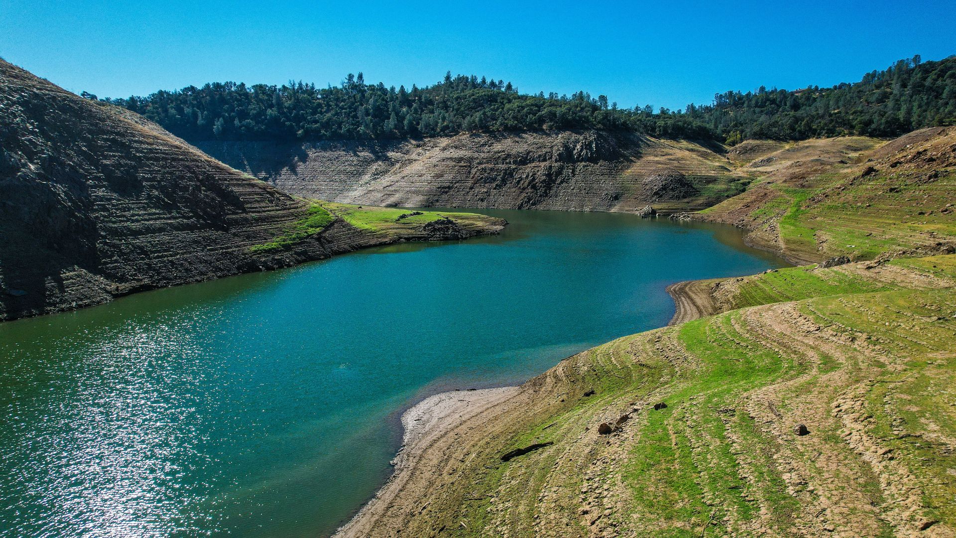
The decline in capacity at Lake Oroville is attributed to a mix of natural aging and fluctuating weather patterns.
The DWR notes the lake’s shrinkage results from “weather swings and almost six decades of service,” demonstrating the environmental and temporal challenges it faces.
Other Challenges in the Area

Reservoir water levels aren’t the only challenge being faced by the Lake Oroville area. Butte County recently faced another common California disaster — wildfires.
Sadly, 13 homes were destroyed, five damaged, 13 other minor structures destroyed, with a further three damaged in a Northern California fiery that burned across more than 3,700 acres.
The Thompson Fire
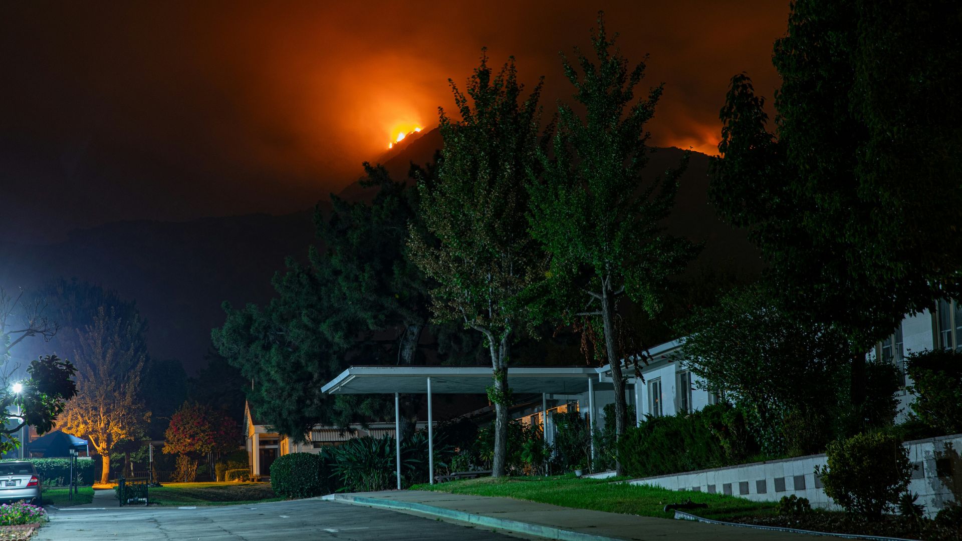
The Thompson Fire ignited in the area of Cherokee Road and Thompson Flat Cemetery and torched more than 3,700 acres before it was finally contained.
A state of emergency was declared by California Gov. Gavin Newsom shortly after the fire began, and local emergencies were also declared as the fires threatened critical infrastructure like the Oroville area water and power supply.
Evacuation Orders
Nearly 17,000 people near downtown Oroville, east to Kelly Ridge, and up just past Cannon Reservoir were impacted by mandatory evacuation orders.
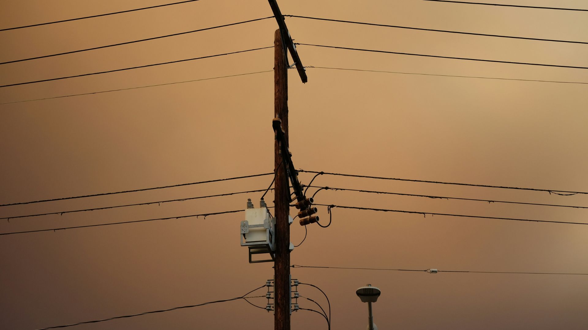
Infrastructure was also affected. The fire impacted operations at the Oroville Dam, and Pacific Gas & Electric were forced to de-energize high-voltage powerlines, meaning the Hyatt Powerplant went offline.
Closing of Lake Oroville

Lake Oroville itself and the majority of the surrounding parks and recreational areas were closed due to the Thompson fire. This closure saw these areas inaccessible to the public on Independence Day.
Oroville cancelled its aways popular Fourth of July fireworks show as the city enforced a temporary ban on fireworks.
A Critical Water Resource
Despite its reduced capacity, Lake Oroville remains indispensable to California’s water infrastructure.
It still holds the position as the state’s second-largest reservoir, essential for meeting the water needs of millions.
Optimizing Operations with New Insights
John Yarbrough, the DWR’s deputy director of the State Water Project, stresses the importance of the updated data, explaining, “Having updated storage capacity data allows us to operate Lake Oroville in a more efficient manner.”
This information is crucial for refining how the reservoir is managed.
A Balancing Act
The updated data is not just about efficiency—it’s vital for safety and supply, particularly under the shadow of climate change.
Yarbrough highlights, “It ensures we are providing adequate flood storage protection during winter months and accurately accounts for the state’s water supply.”
Adapting to Seasonal Changes

The management of Lake Oroville requires a delicate balance between flood risk and water conservation.
In the wetter months, officials release water to reduce flood risks, while in the dry season, efforts shift towards maximizing water retention.
Other California Reservoirs
Lake Oroville, though vital to California’s water management, isn’t the only significant reservoir in the state. And not all reservoirs are faring the same.
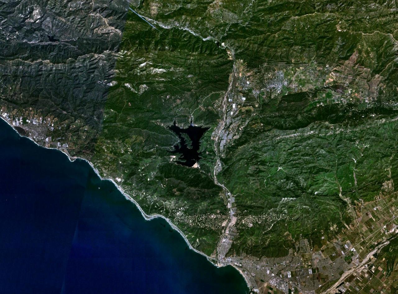
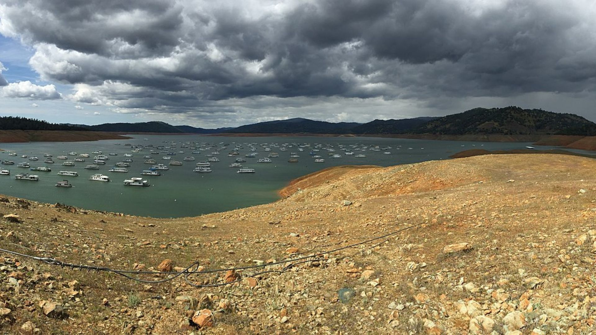
Lake Casitas, in Ventura County, is another reservoir that has struggled with water levels after 25 years of drought.
Lake Casitas
Lake Casitas was created in 1958 and, in the decades since, has faced a number of challenges. Storms, droughts, and wildfires have all taken their toll.
The Lake received 20 inches of water in less than a week in 1960, but then did not fill again until 1978, 20 years after its construction, due to infrastructure damage following a series of storms.
Spilling at Lake Casitas

Lake Casitas is fed by two creeks and a diversion structure. It hasn’t reached its capacity and spilled since 1998.
Over two decades of drought saw to this, though things have been improving recently. Storms from last year pushed water levels in the lake up to 70%. Further intense weather conditions this year pushed the lake further.
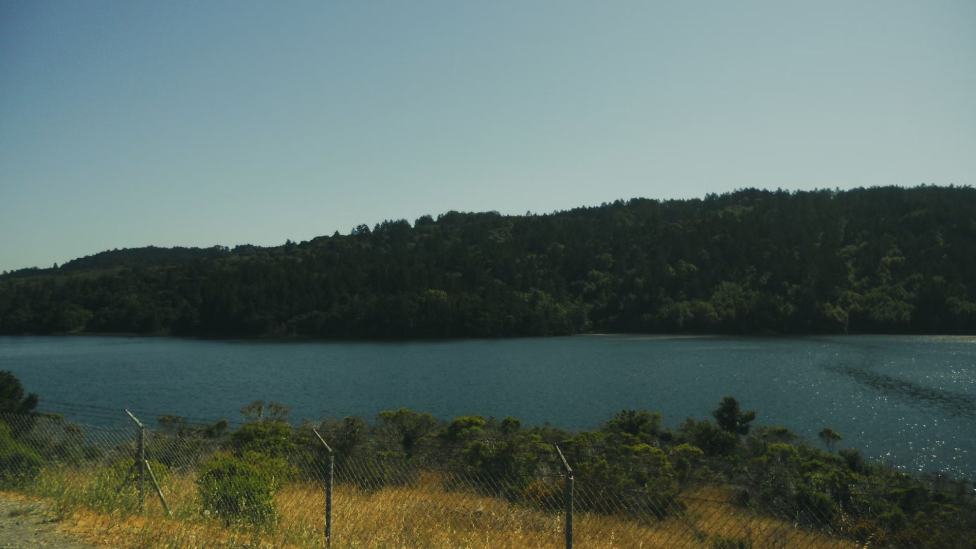
Filled to Capacity

For the first time since 1998, Lake Casitas has been filled to capacity. This is a remarkable turnaround considering the reservoir was at a mere 28% in 2022.
The Casitas Municipal Water District reported that water had reached the spillway’s elevation at 567 feet, and a steady stream of water began to trickle down the spillway once again.
Good News

This is obviously a welcome turnaround for the previously drought-stressed reservoir. Mary Gergen of the water district’s board of directors expressed her own excitement.
Bergen attributes the filling to “two very good rain years”, and the fact that this year’s rainfall was particularly consistent. It typically takes about five or six inches of rain before runoff starts reaching the lake.
Lake Casitas’ Function

Like Lake Oroville, Lake Casitas is a vital part of the state’s water infrastructure, providing drinking water for the Ojai Valley and parts of Ventura.
With the Lake impacted by droughts over the last few decades, residents were forced to curb their water use or risk being fined. Lake Casitas’ filling will obviously be welcome news to all.
Recovery and Decline

From December to May, Lake Oroville’s water levels reached full capacity, demonstrating its ability to rebound.
Yet, as summer approaches, a natural decline begins, reflective of California’s seasonal water patterns.
California Storms

The abundance of water now being enjoyed in California is no doubt linked to the historic storms that bombarded the state.
California was continually being drenched by “Pineapple express” storms. While there are positives, like the reversal of fortunes of Lake Casitas, there have also been drawbacks, like flash flooding.
One Extreme to Another
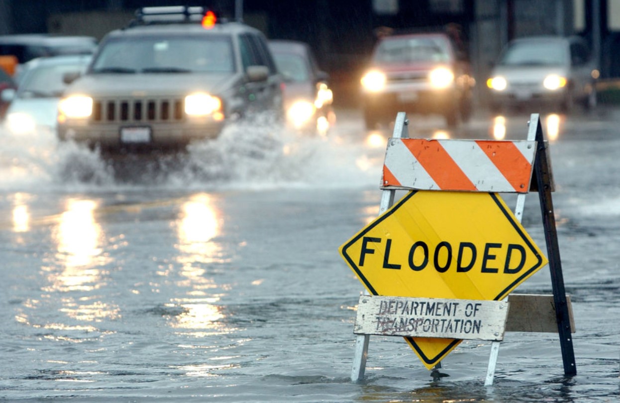
After two and a half decades of drought severely prevented Lake Casitas from reaching full capacity, California is now facing the opposite problem.
The state experienced one of the wettest Februarys on record earlier this year. Residents experienced drastic flooding in February as atmospheric storms moved through the region and deluged the coast.
A Comparative Improvement
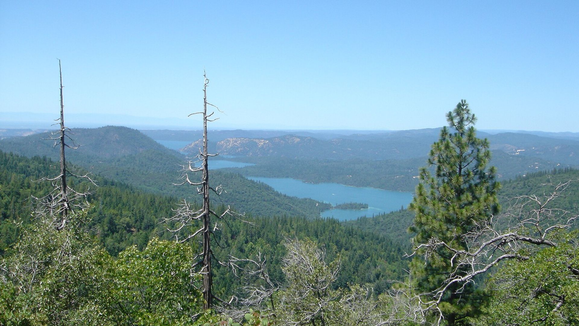
Lake Oroville stands much stronger today than in recent years.
The latest measurements show the water level at 887 feet—only 12 feet shy of its full capacity of 900 feet, a significant rise from the lows of 750 feet seen during the previous summer’s drought conditions.