

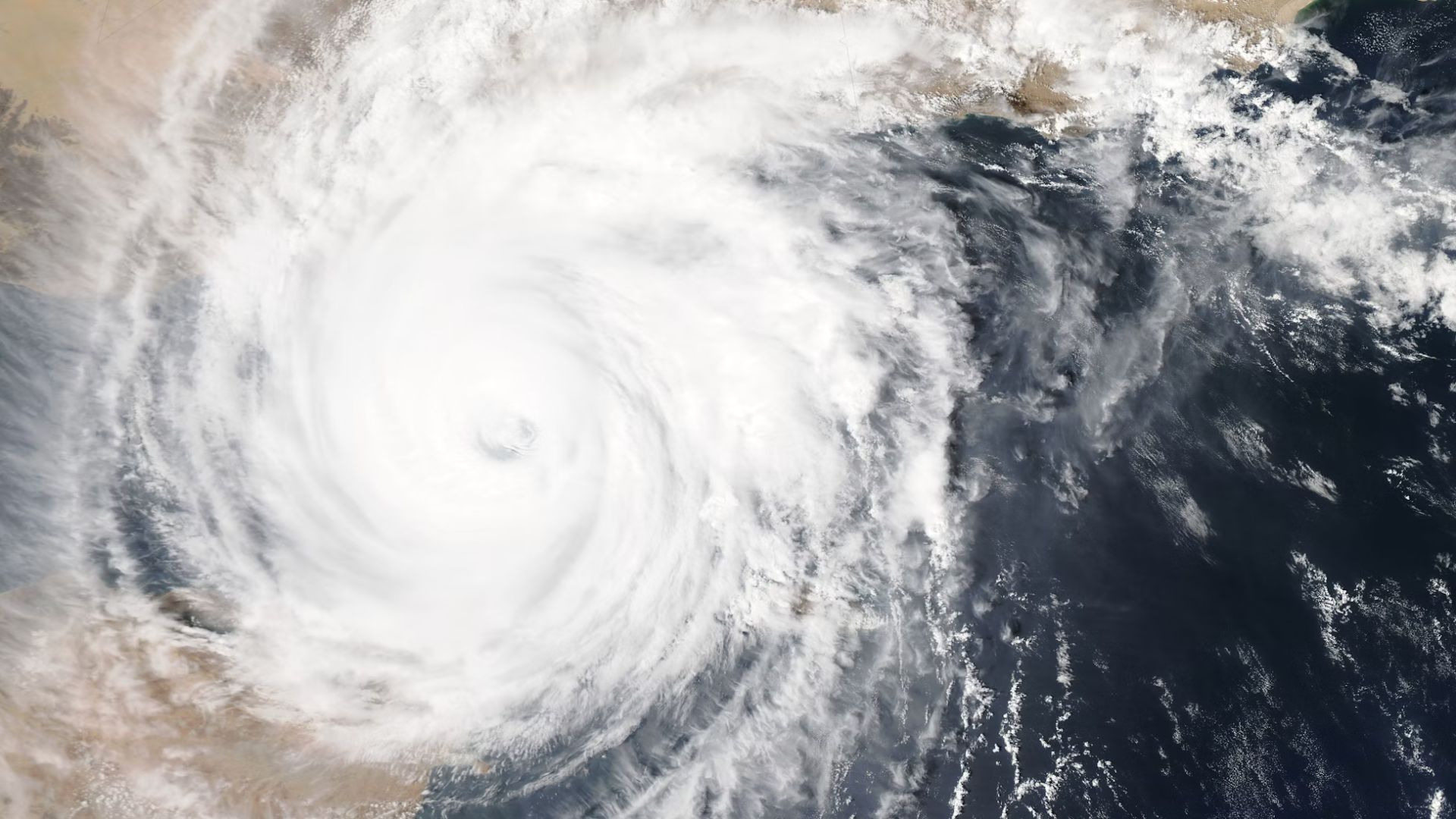
A tropical wave, identified as Invest 97L by the National Hurricane Center (NHC), is forming off the American coastline with a 70% chance of developing further.
Florida could potentially be impacted as the system moves closer, prompting hurricane trackers to monitor the situation closely and raise alerts for possible severe weather conditions.
Heavy Rain Hits Caribbean as System Moves North

Currently, the tropical system is drenching the islands of Hispaniola, Puerto Rico and the Virgin Islands with significant rainfall.
The National Hurricane Center indicates that this system might soon set its sights on Florida, commonly referred to as the Sunshine State, as it continues its path northward.
Possible Development Into a Hurricane
Meteorologist George Waldenberger from Channel 9 News has reported that the tropical wave is likely to develop by this weekend or early next week.
He stated, “For now, expect a higher chance of heavier rains Sunday, Monday and possibly beyond,” highlighting the immediate weather risks as the system approaches.
High Sea Temperatures Could Fuel Storm Intensity

The sea temperatures are unusually high, in the upper 80s, which could fuel the system’s growth into a stronger storm or even a hurricane.
Chief Meteorologist Tom Terry of Channel 9 News noted on Thursday morning, “Water temperatures are in the upper 80s, adding plenty of fuel for this system to grow into Debby — possibly even a hurricane by late weekend and early next week near our west coast.”
Florida on High Alert for Organizing System

As the tropical storm lacks a well-defined center at this stage, it shows signs of organizing as it moves closer to Florida.
Meteorologists are closely watching its development, as the organizing system could bring more severe weather to the state in the coming days.
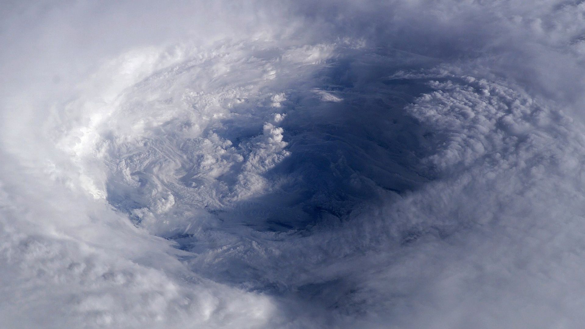
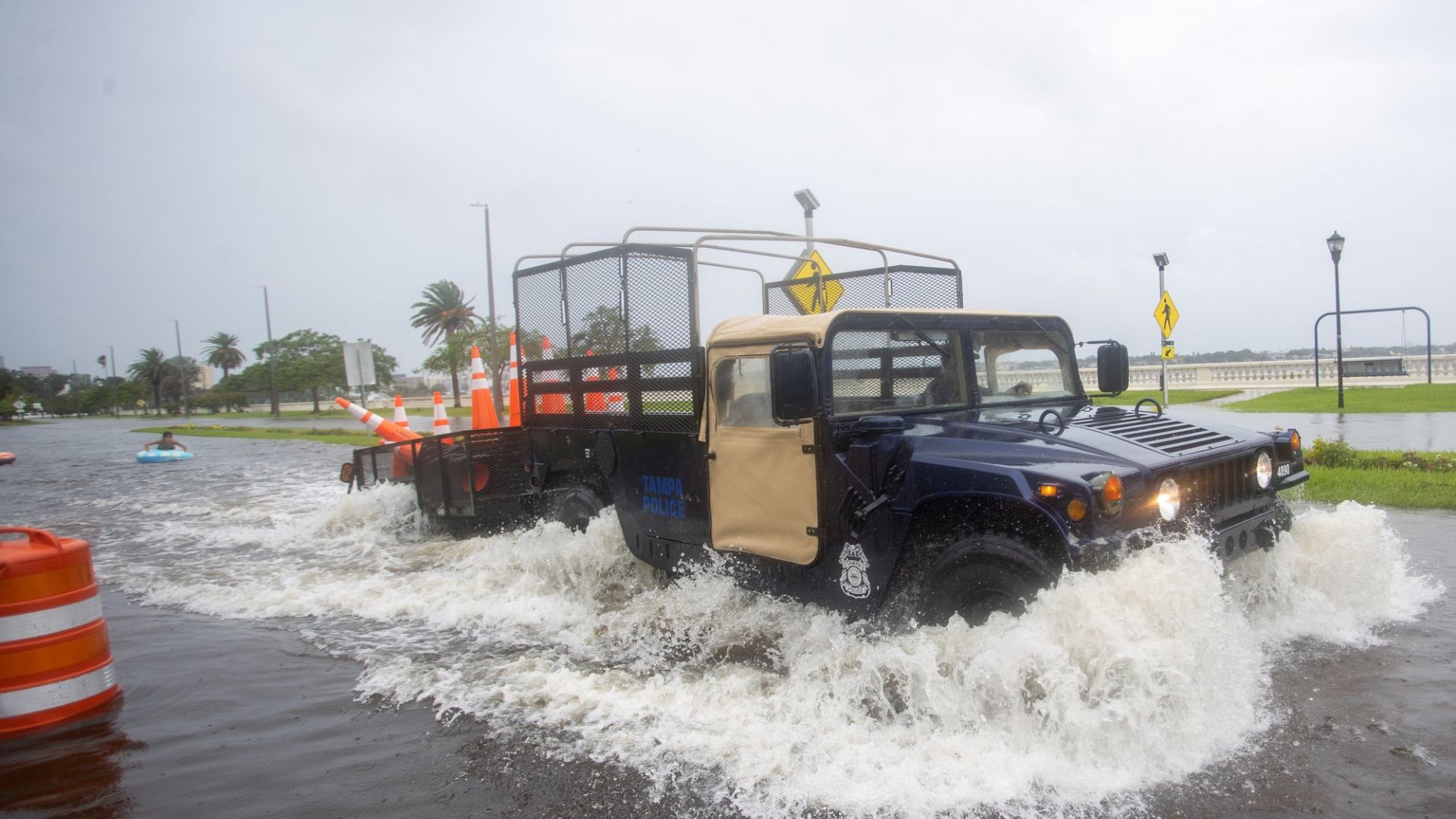
A Life-Threatening Storm
Forecasters had predicted that the storm would soon hit the Florida coast and immediately warned that it would be life-threatening once it did.
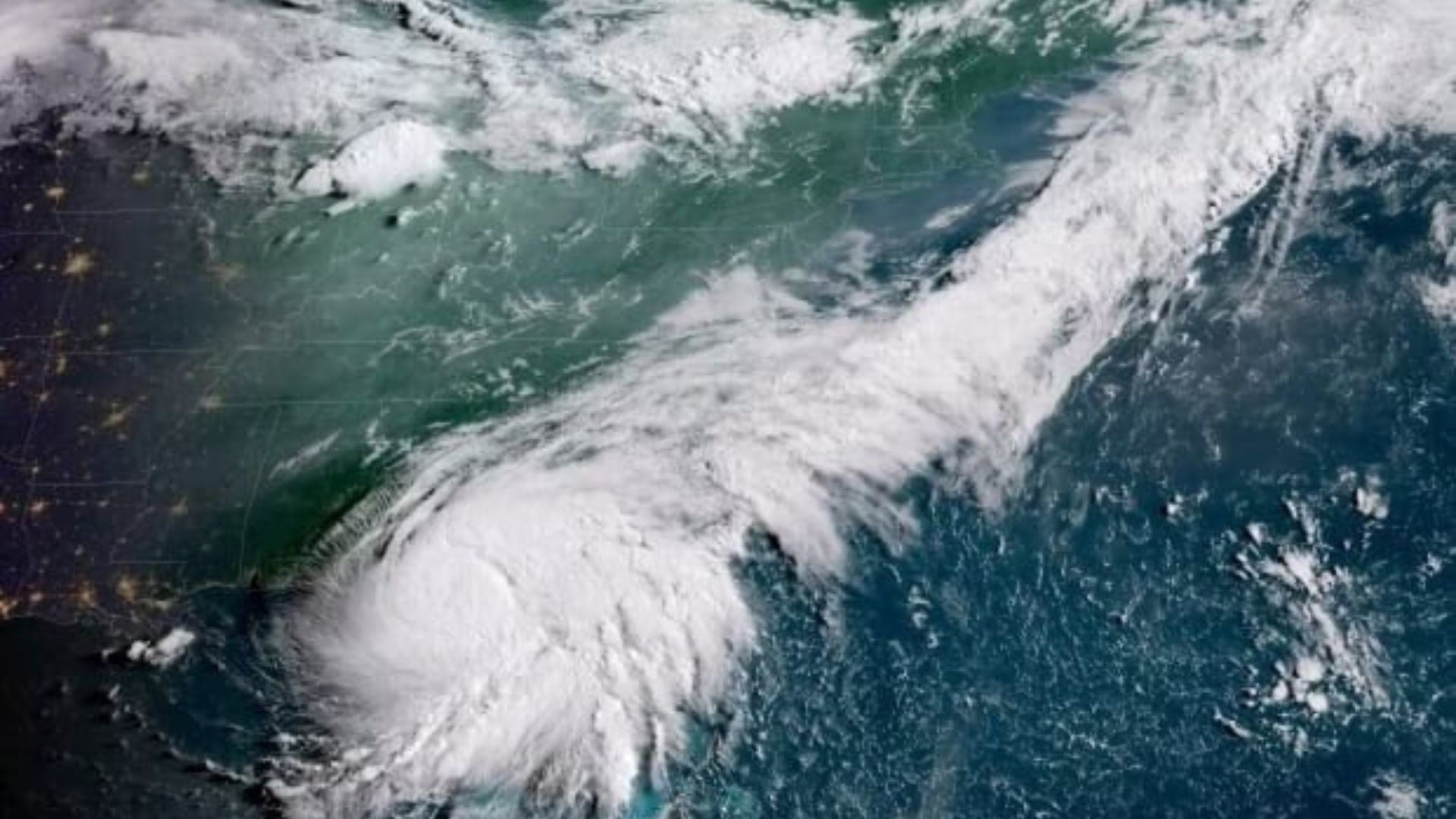
Tropical Storm Debby is likely to at least become a Category 1 hurricane, and forecasters are also warning that there will be a danger to life once Florida is hit.
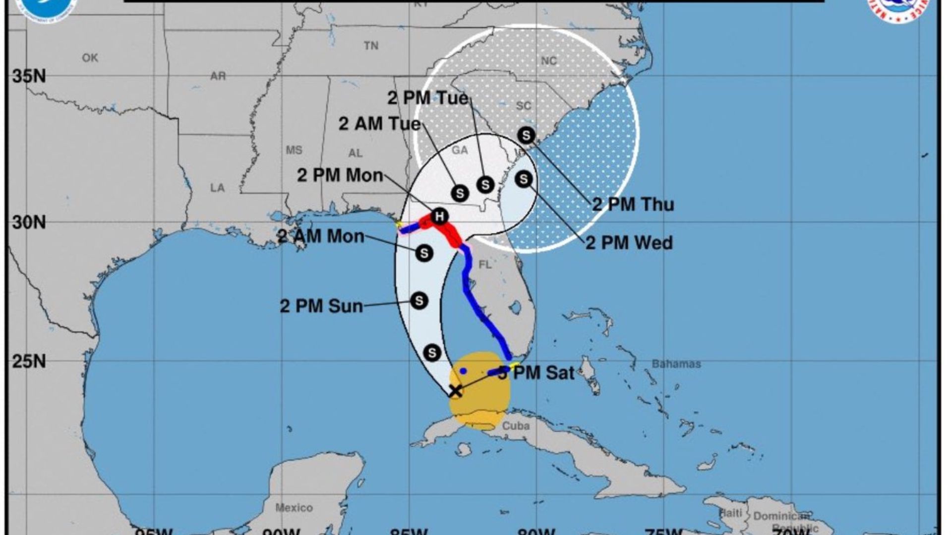
Storm Forecast to Impact Cuba and Bahamas
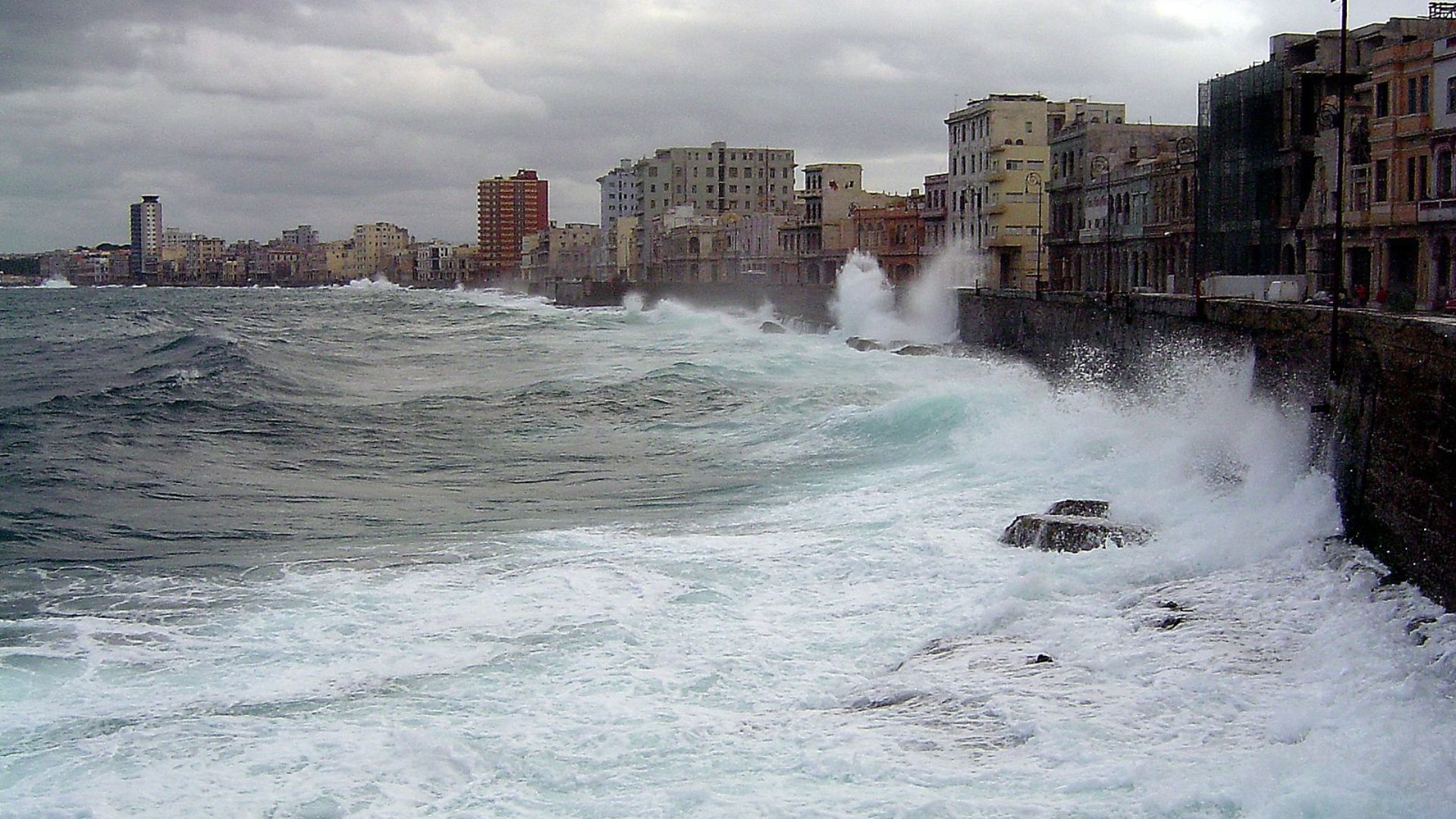
The storm is expected to impact Cuba and the western Bahamas by Friday, bringing heavy rain.
Meteorologists are monitoring its strength and path closely as it could significantly affect weather conditions in these regions before potentially reaching Florida.
Weather Warnings for Southern Florida

The forecast for Florida anticipates downpours and gusty thunderstorms hitting the Keys and southern peninsula by Saturday.
The conditions are expected to escalate from Sunday, with an increased risk of tropical storm or hurricane conditions, according to AccuWeather.
Uncertainty Over Storm’s Exact Path

The trajectory of the tropical wave remains uncertain with possibilities of it hitting Florida’s east coast or diverting into the Gulf of Mexico.
The development and path of the storm are critical factors that will determine the areas most at risk.
Presidential Campaign Stops Have Been Canceled

Tropical Storm Debby has also affected the presidential campaign. Vice President Kamala Harris was meant to stop in Savannah, Georgia, but that is no longer happening.
It is unknown when these campaign stops will be reorganized, but most people’s main concern is ensuring residents stay safe and deal with the storm’s effects.
Recent Hurricane Beryl Impacts
The region is still recovering from Hurricane Beryl, which struck Texas and the Mississippi valley earlier in the month, resulting in at least eight fatalities and leaving more than 2.7 million without power.
This history highlights the potential dangers of the current tropical wave as communities brace for possible impacts.
The Fourth Storm of the Season
Debby is officially the fourth storm of the 2024 season and is set to follow similar paths to Storms Alberto and Beryl.
These patterns suggest that there is more intense activity currently underway in the Atlantic Ocean, allowing for this many storms to happen in such a short space of time.
A Busy Hurricane Season
For those hoping Debby will be the last storm of the season, they are wrong. Things are only set to get worse from here. According to experts, the next few months are set to be very difficult.
They have predicted that a hyperactive period will occur from late August to early October, with a rise in tropical storms and hurricanes. Experts have also warned those who might live in an affected area to remain on high alert and be prepared during this time.
Monitoring New Developments: Debby in the Making

The National Hurricane Center has started to issue warnings about another potential storm, Debby, brewing east of the Lesser Antilles.
Texas Storm Chasers recently posted, “The chances of tropical development have bumped up to 40 percent within seven days,” signaling another storm that could affect the region soon.
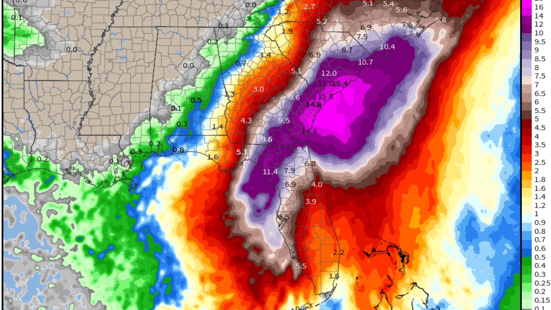
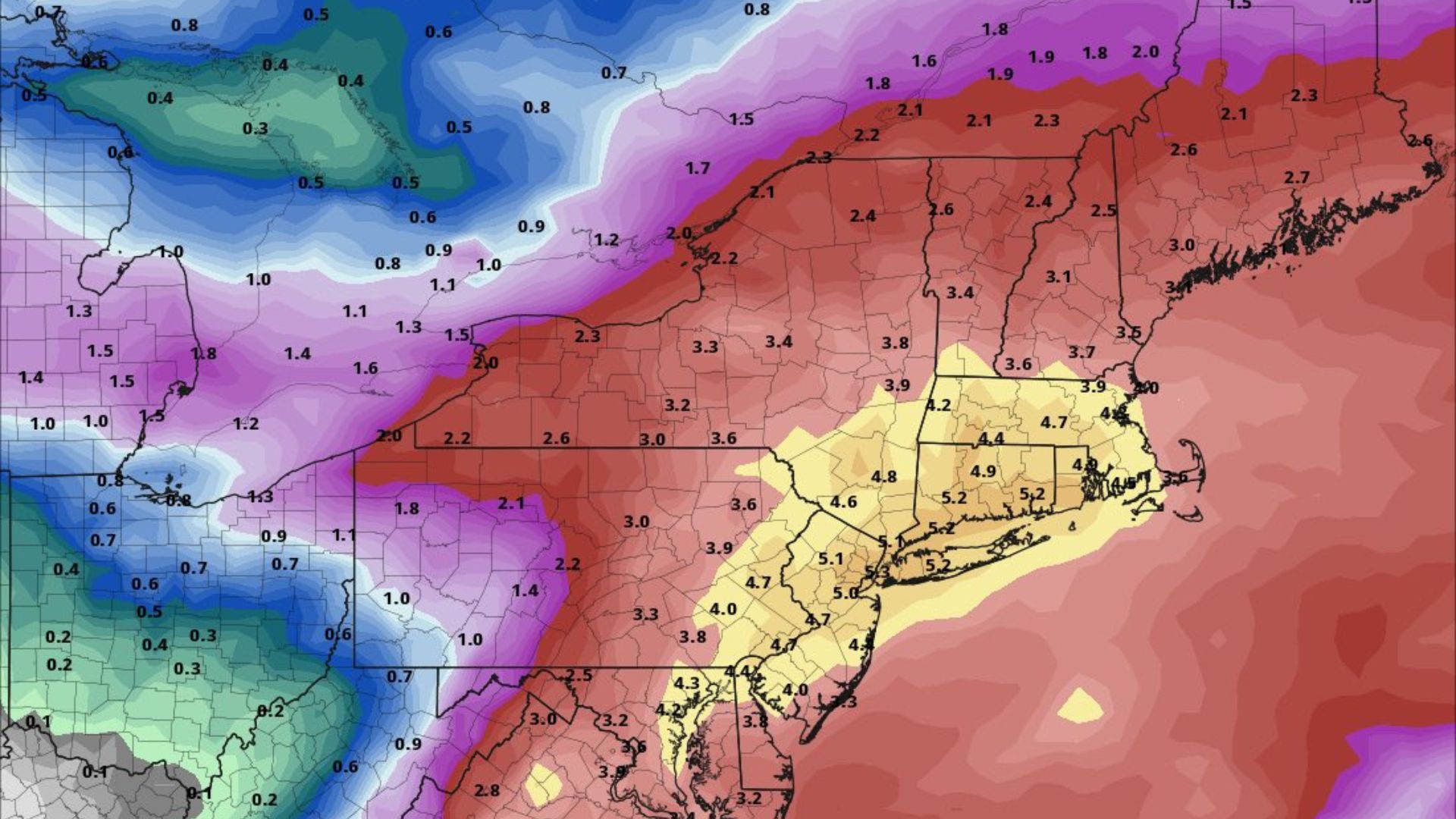
Debby’s Potential Path Across Multiple Regions
Forecast maps show Debby possibly sweeping across the Caribbean and across Florida, with a chance of making landfall anywhere in the Gulf of Mexico or the Carolinas.
These predictions are being taken seriously as they could affect a broad area with varying degrees of weather severity.
Georgia and the Carolinas Set to Be Hit
Georgia and the Carolinas are also predicted to be hit. The National Hurricane Center has warned of life-threatening floods as torrential rain is set to hit these areas.
Residents in Georgia and the Carolinas have been warned to remain on high alert and to keep updated with the weather.
Georgia Residents Told to ‘Hunker Down’
After seeing the mass destruction the storm has caused, Van Johnson, who is the mayor of Savannah, Georgia, has told residents to “hunker down.”
He also told residents that when it did hit, they should expect a “rough day.” Curfews have also been announced from Monday night into Tuesday.
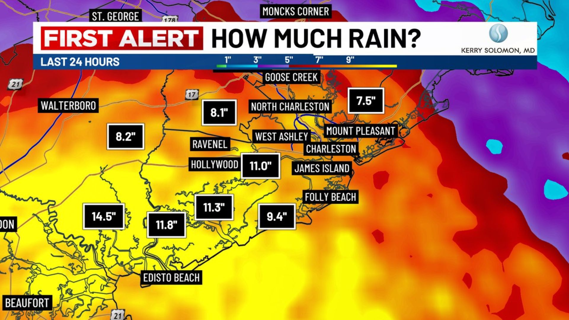
Charleston’s Emergency Plan
In South Carolina, the city of Charleston has announced its emergency plans so that residents will know what to expect should the storm hit.
This includes giving residents sandbags, leaving parking garages open so people with cars have somewhere to park above floodwaters and offering an online mapping system for residents to see which roads have been closed due to flooding.
At Least Five Are Dead
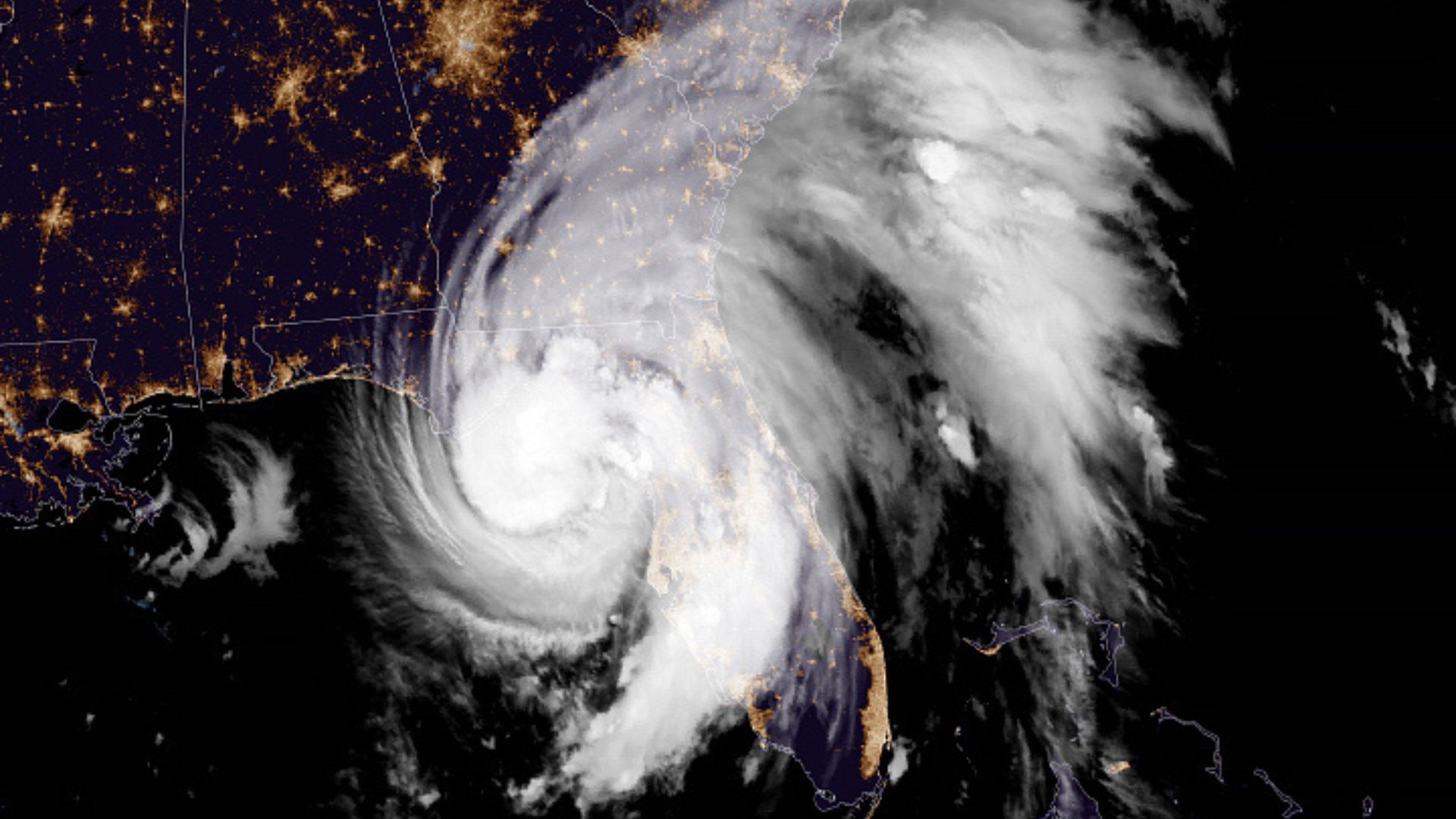
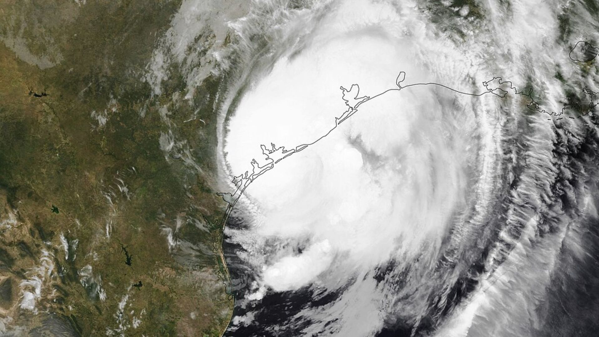
After the warnings that it was set to hit Florida Tropical Storm Debby turned into a hurricane and hit the Sunshine State. As a result, it is believed that at least five people have died.
The affected areas were Levy County, Hillsborough County, Dixie County and southern Georgia. Among those announced dead are a 12-year-old, 13-year-old and a 19-year-old.
Winds of 75 MPH
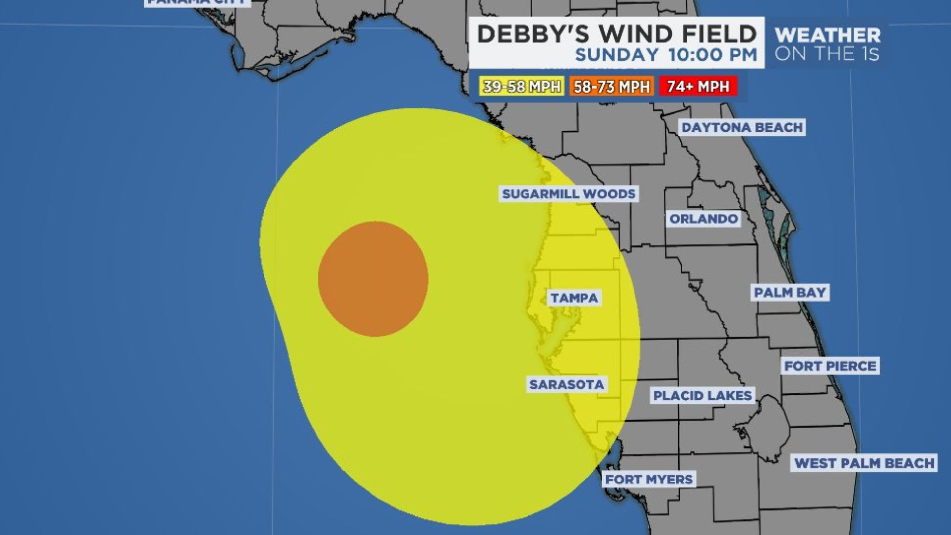
It was predicted that winds would reach at least 80 mph along the Florida coast. However, the winds didn’t get quite that high, which might come as a relief to Florida residents.
Instead, the winds only reached a maximum of 75 mph in the Big Bend region. While these are still strong, they weren’t as strong as predicted.
Thousands Left Without Power

Due to the hurricane’s force, around 150,000 people in Florida were left without power on Monday night, down from the peak of 350,000.
Anyone who was expecting to get on a flight to or from Florida wasn’t able to, as all flights were canceled throughout Monday.
Tornado Hits Edisto Beach
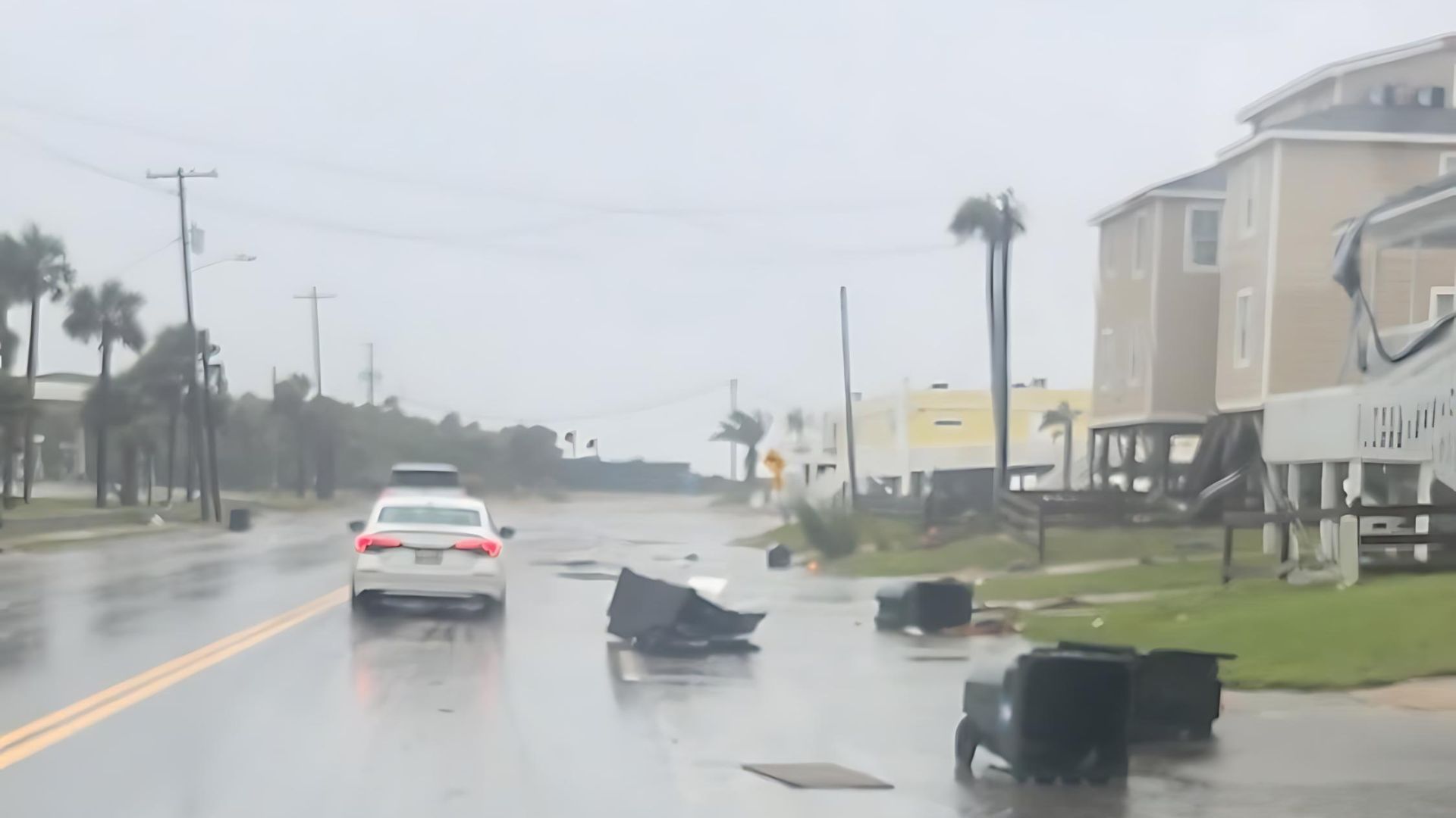
A radar confirmed that a tornado had hit Edisto Beach, South Carolina, just after 9:30 p.m. on Monday.
There were reports of multiple structures damaged by the tornado on the beach, as well as structures across the river from Edisto Island.
Storm Winds Are Expected to Weaken
By 11 p.m. on Monday, the tropical storm winds had gone from 75 to 45 mph.
These winds extended to around 115 miles from the eye of the storm, and the hope is that they will gradually weaken over the next few days.
Preparing for a Storm-Filled August

With August typically being a busy month for tropical activity, the presence of high-pressure areas near Bermuda and over the southern plains could influence the path of the storm toward Texas or up the eastern seaboard.
Emergency services and communities are preparing for a range of scenarios as the storm develops.